
")
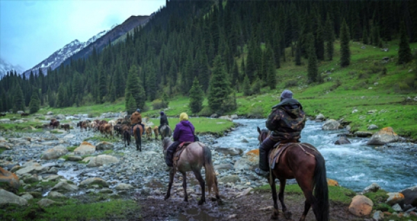
Horse riding
This adventurous trail ride follows part of the ancient silk route. There is a real contrast of landscapes with deep fertile valleys and arid canyons separated by high mountain passes. Reaching the high grasslands, home to nomadic families in summer, the route takes you over open pastures with a stunning backdrop of snow capped mountains.
Welcoming travelers is central to Kyrgyz culture and the opportunity to spend some time with the herders who live their life on horseback is a once in a lifetime experience. Part of the enjoyment of this ride is spending time with the local people you meet along the way which means that the timing can be unpredictable. In addition severe mountain weather can disrupt the itinerary.
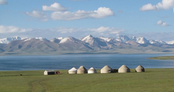
Horse riding tours are one of the most famous activities in Kyrgyzstan. Our country is the best place for real horse riding. For many years nomads were wondering in our mountains with their collapsible dwellings yurts and their herds of cattle. Now is your time to be as a nomad in our untouched mountains. You can ride a horse in our stunning gorges that are so far from the civilization with is noise and polluted air. You will be alone with nature and your thoughts!!!
| Highest Point: | 3600m |
| Lowest Point: | 1670m |
| Total Elevation Gain: | 4660m |
| Total Elevation Loss: | 6350m |
| Level of Difficulty: | Difficult |
| Total Hours Hiking: | ~61Avg |
| Total Amount of trekking days: | 14 |
| Approximate Trekking Distance: | ~213km |
| Total hours of driving: | ~15hours |
| Total kilometers of driving: | ~924km |
| Highest Point: | 3600m |
| Lowest Point: | 2200m |
| Total Elevation Gain: | 4911m |
| Total Elevation Loss: | 4311m |
| Level of Difficulty: | Medium/Difficult |
| Total Hours Hiking: | ~46Avg |
| Total Amount of trekking days: | 8 |
| Approximate Trekking Distance: | ~111km |
| Total hours of driving | ~22hours |
| Total kilometers of driving | ~954km |
| Highest Point: | 3860m |
| Lowest Point: | 1860m |
| Total Elevation Gain: | 2960m |
| Total Elevation Loss: | 4090m |
| Level of Difficulty: | Medium/Difficult |
| Total Hours Hiking: | ~30Avg |
| Total Amount of trekking days: | 7 |
| Approximate Trekking Distance: | ~115km |
| Total hours of driving | ~15hours |
| Total kilometers of driving | ~907km |
| Highest Point: | 3671m |
| Lowest Point: | 1670m |
| Total Elevation Gain: | 2290m |
| Total Elevation Loss: | 2670m |
| Level of Difficulty: | Medium/Difficult |
| Total Hours Hiking: | ~30Avg |
| Total Amount of trekking days: | 6 |
| Approximate Trekking Distance: | ~88km |
| Total hours of driving | ~16hour |
| Total kilometers of driving | ~958km |